

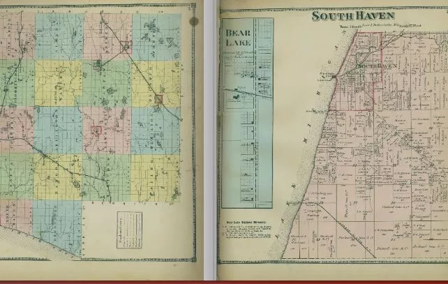
The Van Buren County GIS Department has published several historic plat books that show property records going back as far as 1873.
GIS Director Jerry Happel tells us the department wanted to preserve old records while it still could, so they’ve all been put online for anyone to see.
“These are books that we had here on hand, and they’re getting so old and they’re starting to deteriorate, and we really don’t want to be handling them anymore,” Happel said. “So, we made the effort to go ahead and scan them and put them on the internet, make them available to the public.”
Happel says land ownership books from 1873, 1895, 1906, and 1912 have been carefully scanned, and now anyone can browse them. He says it’s fascinating to see how Van Buren County developed over the years by looking at the maps.
“To me, it’s just interesting to see how the land has developed over time. Way back in the day, there were a lot of very large lots and people owned hundreds and hundreds of acres. And of course, it’s been whittled down since then. I find it fascinating just to see the history of it.”
Happel says you’ll notice names that are still well-known in the community. The books are also downloadable in PDF format, catering to the needs of historians, genealogists, educators, and anyone interested history.
The GIS Department is also working on creating an interactive map that will allow users to overlay present-day parcel information onto the historical plat book data. That’s set to launch later this year, giving everyone more of a chance to see how the county developed.

